

Best Learning’s iPoster My WORLD Interactive Map is a “beautifully illustrated large floor map for kids, great for interactive lessons in school or at home. Explore and discover the world with your fingertips!
The smartest way to learn the world which includes 92 countries, capital cities, flag, population, languages spoken, important landmarks, fun facts with 4 challenging quiz modes.
Learn over 1,000 facts about the world we live in!
Capital & Country – Learn about each country and its capital cities with quiz.
Flag – Learn about each country’s flag with quiz.
Population – Learn about the population of each country.
Language – Learn about the languages spoken in each country.
Landmark – Learn about the important landmark or monument of each country with quiz.
Fun Fact – Learn a fun fact of each country with quiz.
- Family Choice, Mom’s Choice Gold Metal & Tillywig Brain Child Award Winner 2018! The most valuable interactive touch activated talking map.
- Learning has never been so much easy and fun. Hang on a wall, play on the floor or use as a colorful play mat.
- Learn capital cities, countries with their flags, population, languages spoken in each country, important landmarks, fun facts with volume control.
- Skills learned include concentration, earth science, memory, problem solving, geography and environment.
- Requires 3 AAA batteries (included); intended for Preschoolers and early learners of ages 5 and up.”
Ricki’s Review: We received this map a few weeks ago, and my kids take it out to explore again and again. I love how it isn’t just a simple, straightforward map with just countries. The different settings allow kids to explore more about our world. For instance, my older son seems to gravitate towards learning the country names, capital cities, and landmarks, yet my younger son is fascinated with the flags, and he regularly puts the map on the flag mode.
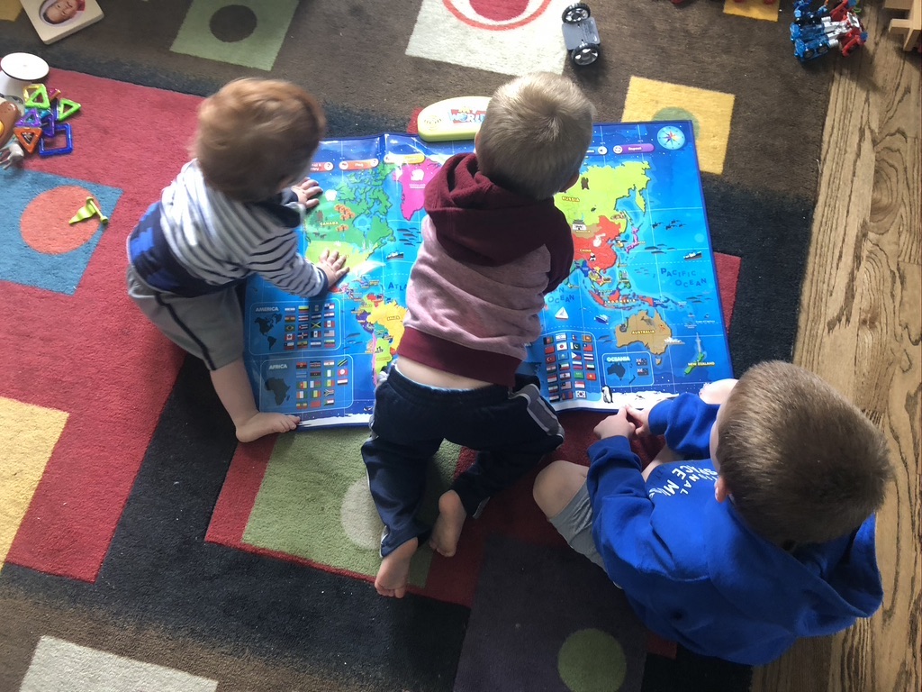
When we first opened the map, all three boys were interested. They learned to take turns learning about the countries. The baby is only included in this picture because as you see, he prefers to push everything at once.
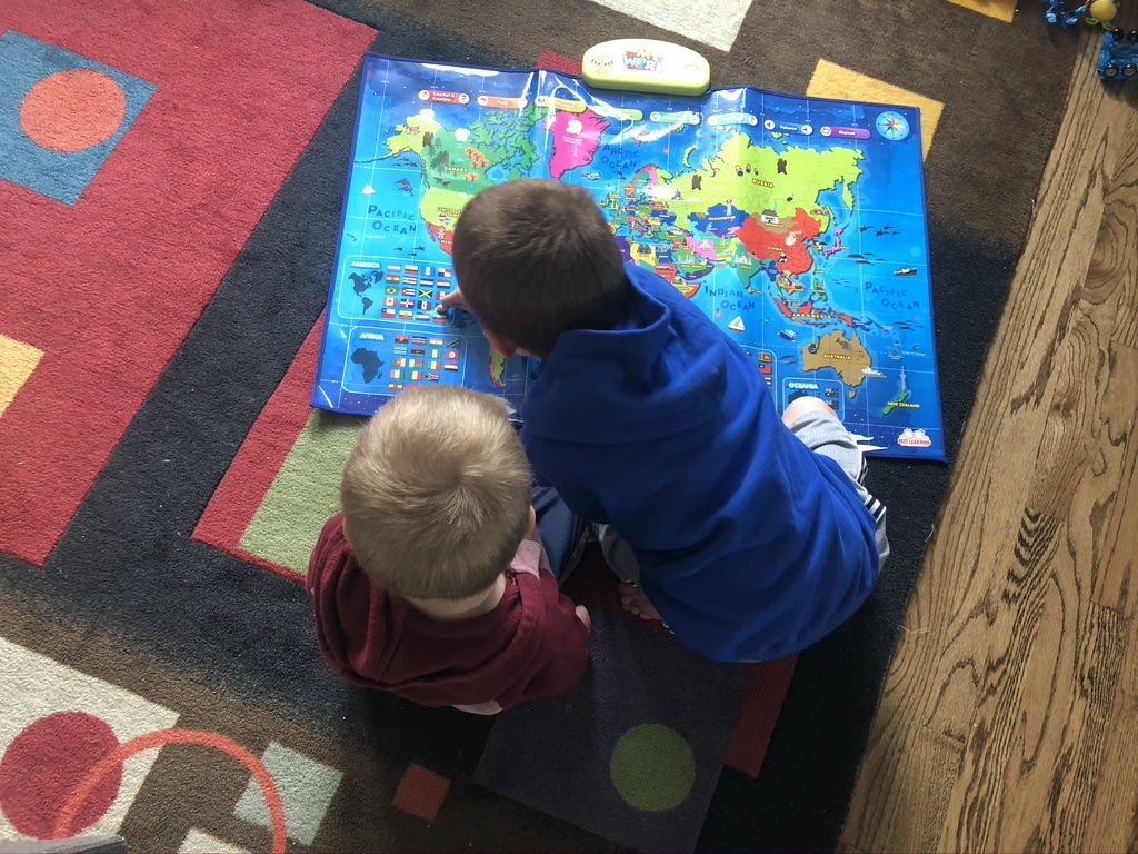
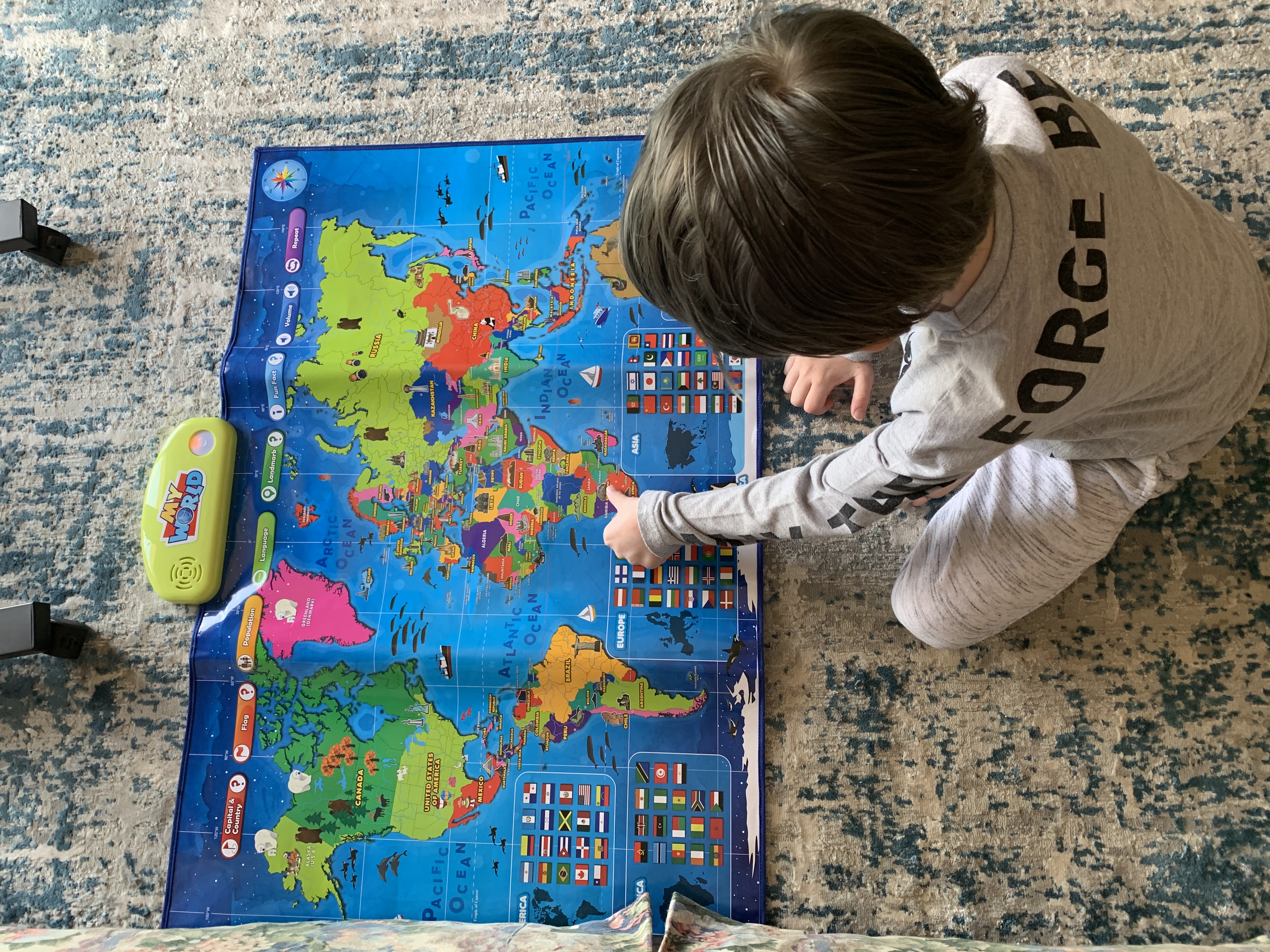
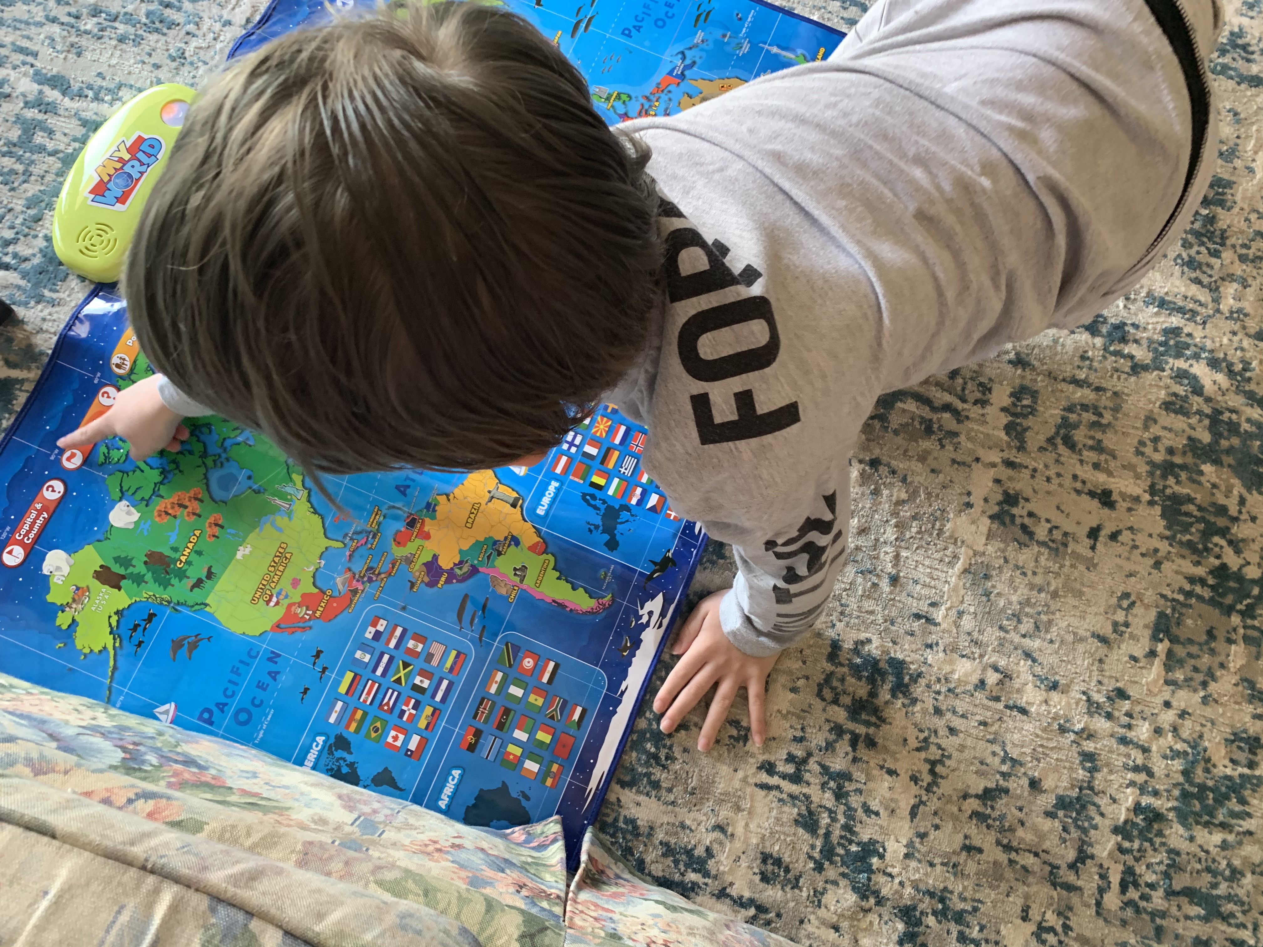
Here, my oldest son clicks on the flags to learn about the countries they come from.
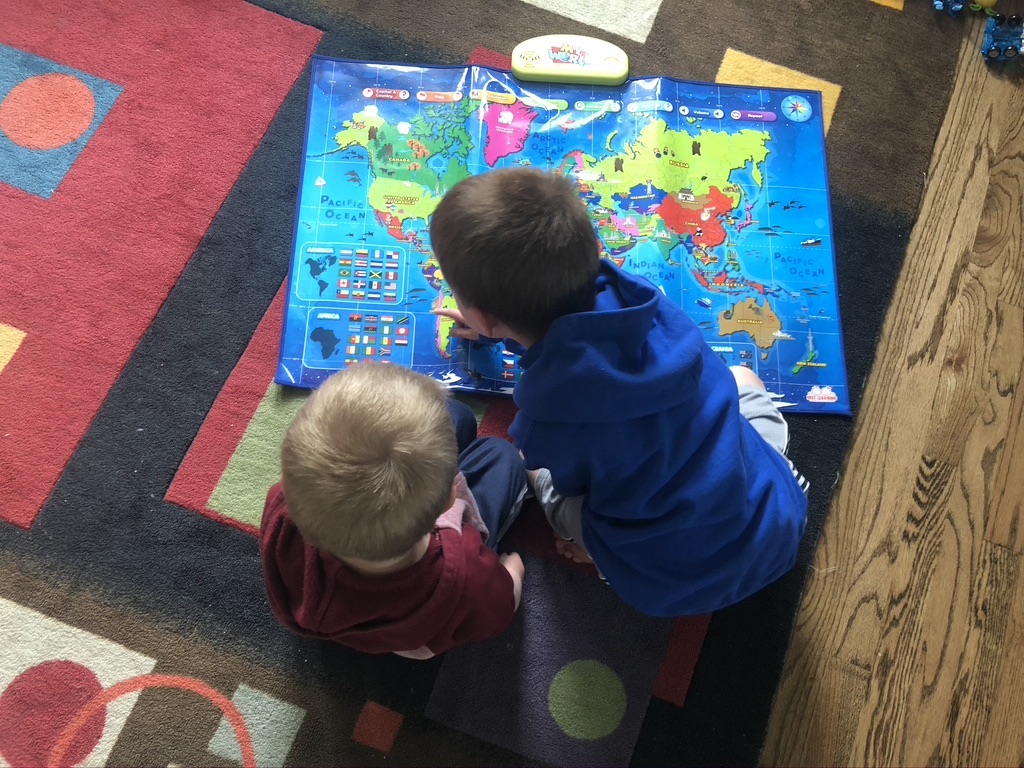
And here, the kids take turns trying to identify the correct country in a fun quiz.
We plan to move the map to the wall this week, and we are happy that it will be something that the kids can keep referring to. I can’t count the number of times that one of them asks something like, “Where is XXXX country, city, or monument?” The map will offer a fun way to not only identify the location but to also learn more about the countries as they pop up in teachable moments.
Kellee’s Review: This map is endless entertainment and information! For those of us who have inquiry-driven kids, the freedom of the map and plethora of information just lends to their natural curiousity. So often I would get questions about a setting of a book or movie or just a random country that he heard somewhere, and now we can visit the map to find the country and learn all about it.
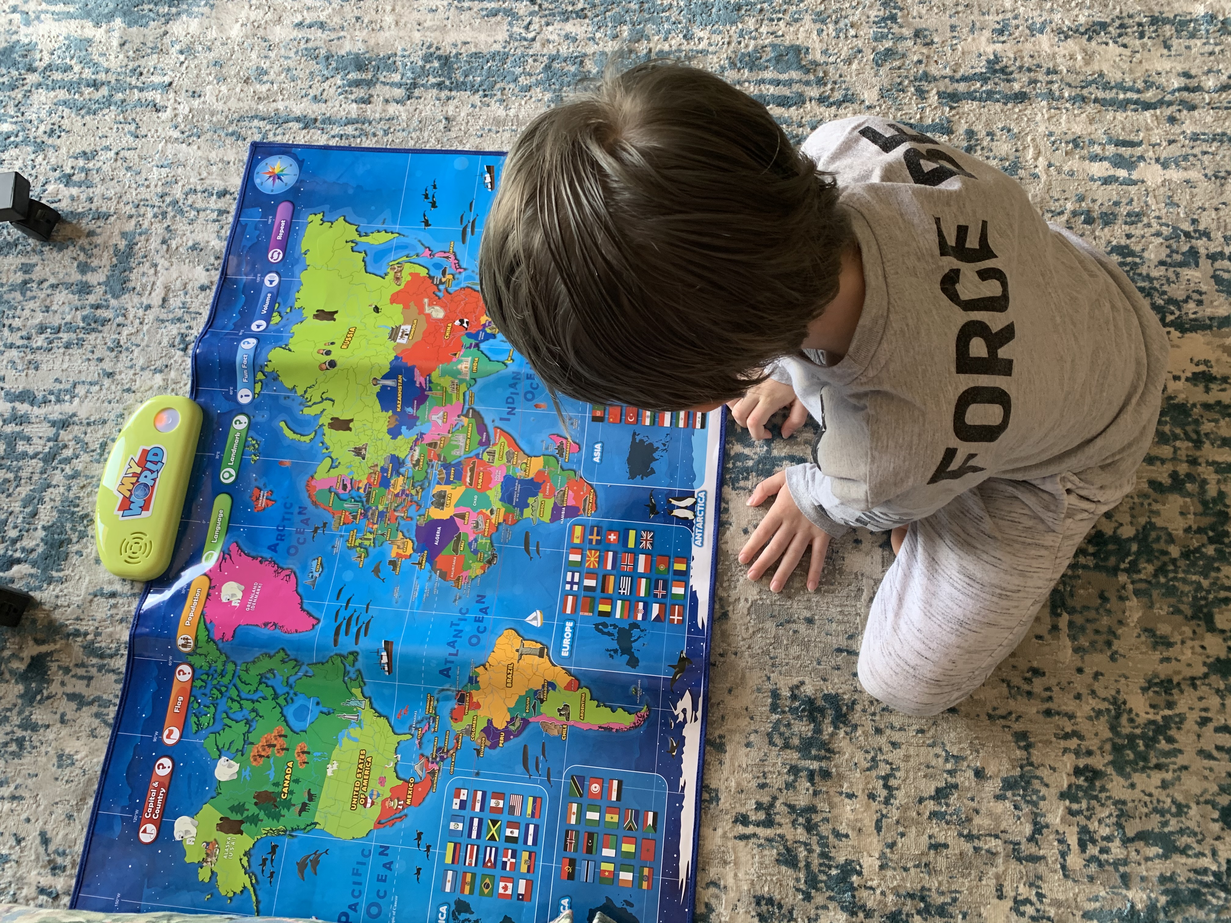
Trent is a fan of landmarks. He can tell you where the Eiffel Tower, Statue of Liberty, Pyramids of Giza, etc. are, so he immediately gravitates towards learning about them with the map. And he just adores quizzes and will relisten to information and retake quizzes until he knows things by heart and will randomly share information with strangers. He says that this is his favorite part: “I love that the map tells you what the place is and tells you everything about the place.” It is all of the interesting information that keeps him gravitating towards it.
While Ricki loves that it isn’t just a simple map, I understand what she means, but I love that in the end it is still a map. Although there are some graphics, it isn’t overwhelming, and we can still use the map as a map also. I love that something that Trent goes back to over and over is fun and educational!
Teachers’ Tools for Navigation: This map would be a beautiful addition to classroom walls. It offers so much more than a simple, paper map, and it allows kids to learn more about our world. We would recommend using velcro strips to hang this map on classroom walls to allow kids to pull the map off of the wall and bring it to their seats for further investigation.
 and
and
**Thank you to Best Learning for providing maps for review!**
Oh, my girls would have LOVED this. We did have a globe that ran on batteries and asked questions– one of the few times I allowed batteries in the house. What fun!